London's abandoned Underground Stations on Google Street View
Google's new street views of London use some cutting edge technology to capture, map and display our city. They've also captured some of the most intriguing reminders of the past of our transport system - what remains above ground of London Underground's "ghost" stations.
The network is littered with buildings that belonged to stations that closed their doors to the public because routes were changed and diverted, or because there was just too little traffic to make them viable. Here are some of the remnants of disused Underground stations that you can see on Google's Street View of London.
 Aldwych
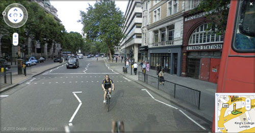
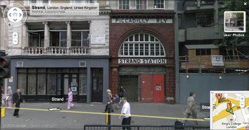
Aldwych station started its life as Strand Station, and adopted the new name in 1917. By then the station had already proved to be little used, and the original service had been reduced to a one train shuttle. Nevertheless the station remained open until 1994.
It could have been different. The original plans for the Jubilee Line, or 'Fleet Line' as it was when developed, originally envisaged the route continuing on from Charing Cross eastwards, and using Aldwych as an interchange station with the Piccadilly Line. Indeed, tunnelling work was started on this section.
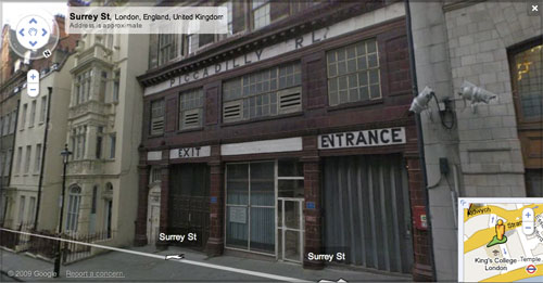
With the station's demise being so recent, Aldwych is one of the best known disused Underground Stations, and the well preserved interior has doubled for other London Underground stations in a lot of film and television shoots.
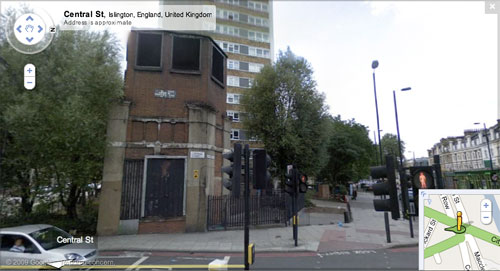
 City Road
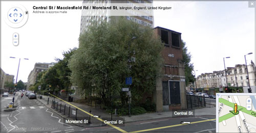
City Road was a station on the City & South London Railway, which became part of the Northern Line. Situated between Angel and Old Street, it was closed on the 8th August 1922. The cost of modernising the station proved prohibitive for the amount of use that it was getting. Although you can see the remains of the platforms from trains, all that remains above ground is this ventilation shaft.
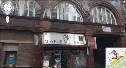
Down Street
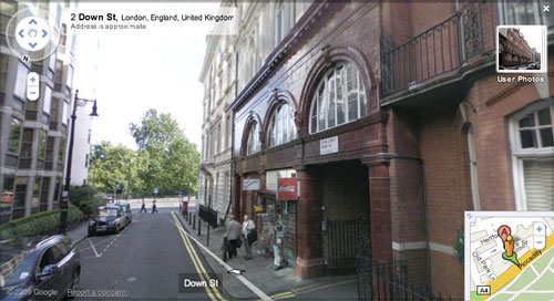
Down Street Station closed in the 1930s, this time on the Piccadilly Line. It was a victim of improved access to nearby Green Park and Hyde Park Corner stations, and a distinct lack of business. It was subsequently used as a bunker by Churchill during the Second World War.
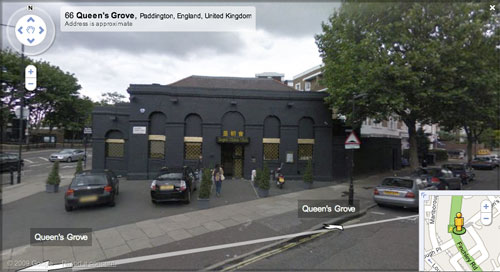
 Marlborough Road
Marlborough Road, along with Lord's, disappeared from the Metropoliton line in 1939, when the running arrangements between Finchley Road and Baker Street were adjusted. This was done to ease congestion, and to make use of a new deep-level tunnel as part of the Bakerloo line.
The Lords station building has been demolished, but you can still see Marlborough Road on Google Street View. What used to be the station is now a Chinese Restaurant.
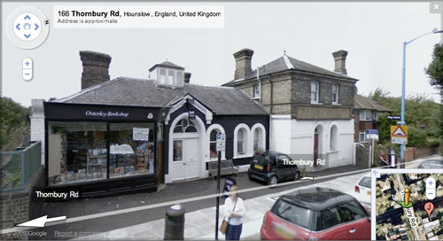
Osterley & Spring Grove
Osterley & Spring Grove was the original name for Osterley Station, which was situated about 300 metres away from the present location of Osterley. The building remains on Thornbury Road, and in Google Street View you can see that it is now a book shop.
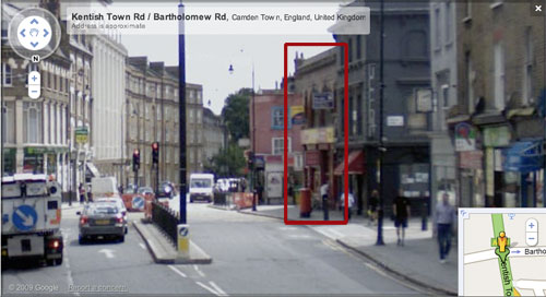
South Kentish Town
South Kentish Town, which would have been on the Northern Line, has one of the strangest closure stories. It was shut due to a strike at the Lots Road power station on the 5th of June, 1924 - and simply never re-opened.
Sadly, due to the oddities of the one way system around this section of Kentish Town Road, Google Street View hasn't captured a good picture of the building at all.
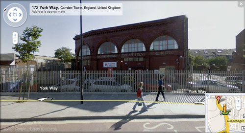
York Road
There must be something about abandoned Piccadilly Line stations that attracts me. I worked in Bush House, virtually opposite the remaining facade of Aldwych station, and now I am at The Guardian's offices in Kings Place, a stone's throw away from what remains of York Road Station.
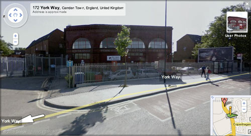
Being so close to Kings Cross, the station was little used, and closed in 1932. However, from trains you can still see evidence of the platforms, and also the underground signal box that remained manned until 1964.
Fascinating set of photos; thanks for putting them together.
Abandoned London Underground Lines and Stations on h2g2. Couldn't resist the plug. Now if it could only be illustrated with the photos you dug out!
For some reason Streetview didn't go up Kentish Town Road to the delightful cashconverters (and South Kentish Town station)
I was going to say "wot no Brompton Road" but I looked at the Streeview pics around the Oratory and realised there's a bus in the way.
Yes, Brompton Road was on my 'wish list' when I started researching, but it is even harder to spot than South Kentish Town was.
Excellent work.
Fascinated with the old stations on the tube network, and never thought to use Street View in this way, even after looking up the Limehouse spur which is disused.
Two thumbs up!!
Nice set of photo you have there. Went to London City 3 years ago and got confuse with tube line name. There are too many. I think if they use colour instead of name will be more easy to follow. Anyway it just a thought.
Great use of Street View - I've been doing some research on google street view as part of a small sociology seminar paper on how street view impacts people interaction with their surroundings - this is definitely a nice example :-)
When I visited a couple years ago I was with my friend as I passed the Down Street Station. I asked him about the station and he gave me the history as best as he could as it related to WWII. Seeing this picture brings back memories of a lovely vacation :) Great use of Google Street View
I had no idea there were so many still visible. Great set of photos indeed!
Well, what do you expect people to do when they're terrified? Who's gonna go down into the stations when the world is rife with terror. Who know......maybe the guy walking down the stairs, carrying the bag, might just bow himself up in five minutes! LOL!
Robert, of all the dumb comments left here with the sole purpose of trying to get a link back to a lame web service, that has to be the dumbest yet. Well done. LOL etc etc!
LOL!
There were two typo's on the comment.
*who knows and *blow
At least I had the sense of humour!
"At least I had the sense of humour!" - I think the jury is still out on that one ;-)
i think the thing that got me here is the dates. I never realised london's transport system is so old. its done pretty well over the years...
its almost sad to see so many unused buildings left to rot, though looking at those photos does make me think most of the stations on the underground would now serve better as relics.. pretty to look at and an interesting piece of history, but cold, smelly, falling to bits and uncomfortable probably doesn't make for a practical subway station. that said i'm a huge cynic that has probably been swayed by a few months using shanghai's metro!
in any case, very interesting use of streetview. a great example of what it can do. wish they had it in china, but that's probably unlikely to happen any time soon...
Abandoned stations fascinate me, but for some reason I thought there were only a few in London - i.e. not this many! I'd love to go in and explore them, plus some of London's many disused tunnels (including old underground lines). Thanks for the entertainment. BTW, I agree with Steph, these buildings should be preserved. We need to be careful not to let too much Victorian architecture go.
If you think the London system is old have you been to New York lately?